|
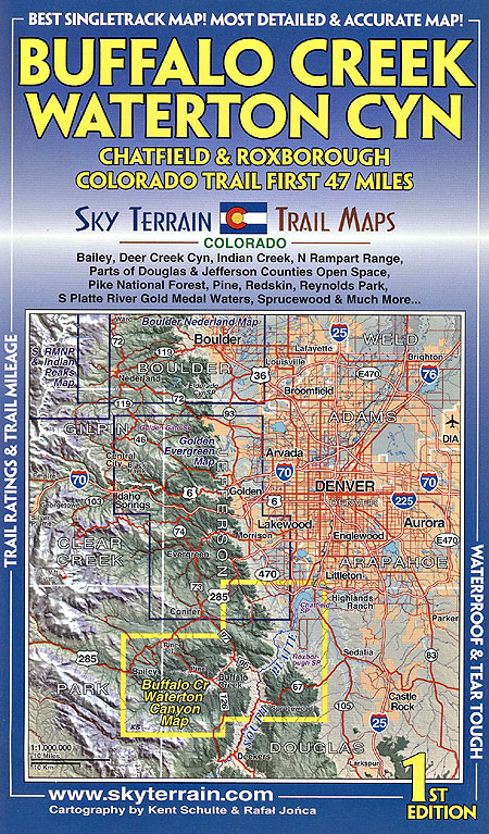
New map covers a big chunk of the greater Denver foothills. This is large country with plenty of good and even great trails for everyone. See Front Cover for map coverage. We used 8 different sets of road and trail data and our own GPS to produce the most accurate, detailed and
up to date map of the area. And at $8.95 the compact, yet full, map is the absolute best value and highest quality. As some mountain bikers have
commented: “You really do have every single switchback!”
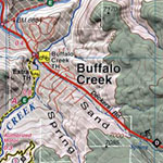
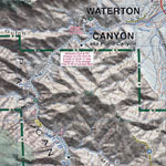
Beautiful areas mapped include Bailey, Deer Creek Canyon, Indian Creek, N Rampart Range, Parts of Douglas and Jefferson counties Open Space and the Pike National Forest, Pine, Redskin, Reynolds Park, S Platte River Gold Medal Waters, Sprucewood and Much More...
Map Features:
- 50ft contours; Enlightened Shaded Relief reveals the rugged terrain.
- All trails rated for difficulty; mileage between junctions mapped. Plus mileage for some big loops shown.
Singletrack mapped.
- Hiking, road biking, mountain biking, fishing, climbing, hunting, camping, white water, horseback, 4wd, and motorsports information.
- Folds to 4 x 6.75 inches
|